DRAFT – This is a work in progress
For infrastructure GIS in Maryland, most GIS systems store geometry in the Maryland State Plane NAD83 coordinate system. That standard was adopted in 1987 and required by 1992. (1) However, the average age of a water main in the Baltimore metro area is 70 years and a lot of it is older than that. When you look at those drawings those you will find other coordinate systems. What are they and how do you identify them?
Maryland State Plane NAD83
Let’s start with the current one. It’s commonly called Maryland State Plane NAD83 and the EPSG code is 2248. A large false easting is used to keep all the numbers positive and to distinguish it from NAD27.
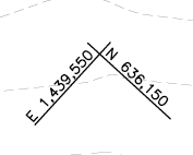
- Minimum X:~600,000 feet
- Minimum Y:~90,000 feet
- Maximum X:~1,900,000 feet
- Maximum Y:~800,000 feet
If your coordinates are outside these values you are out of state or you’ve guessed the wrong system.
Maryland State Plane NAD27
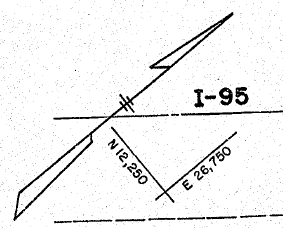
Prior to NAD83 we had NAD27. This system also uses false easting to keep the numbers positive but the range is lower. You should not see these coordinates on drawings dated after 1992.
- Minimum X: ~80,000 feet
- Minimum Y:~35,000 feet
- Maximum X:~1,400,000 feet
- Maximum Y:~700,000 feet
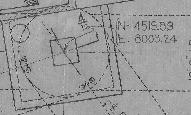
Baltimore City
Baltimore City and water projects in Baltimore County will have tick marks using Baltimore’s coordinates system. The point of origin is the Washington Monument at North Charles St and Monument St. False easting and northing are not used. Negative numbers are used south and west of the origin and the values are small compared to the state systems. There is no EPSG code for this system. You can download the projection file here.
Washington Suburban Sanitary Commission’s (WSSC)
Content Pending